
I first visited the ruins at Keet Seel in 2001. I had read up on how fascinating the ruins were, after all they are the largest most well preserved Anasazi ruins in Arizona and I really wanted to see them. I was grossly overweight at the time and while hiking the trail I swore if I got out of there alive I would never go back. In the next four years or so I managed to drop a lot of weight and since 2001, including this last time, I have hiked this trail 4 times. Each time vowing I will never do it again. But I found myself drawn to go out there yet again, with a group of Sierra Club hikers. I organized the trip and made it perfectly clear how tough it was. I do it in a two day backpacking trip, Memorial Day Weekend usually works out well, where we spend the first night camped at the Navajo National Monument visitor's center campground. The next day bright and early we start in on the hike to make it out to the campground near the ruin by at least 3:30 so we can grab the last tour of the day. As people tend to be destructive, they only allow a guided tour of this ruin and you go up with a ranger. I posted the event in the Sierra calendar earlier in the year to secure participants and to make sure I got permits for 10. The permits are free and there is a 20 person limit per day with a 10 person limit per group. I defined this explicitly in the description and the trip rapidly filled up and there was a waiting list. I tried to keep everyone well informed about the trip and made sure they knew the rules. Also to re-iterate the participant limit and the fact there was a waiting list, so to please let me know if they were going to cancel. I still ended up with three people calling in sick at the last moment, and one complete no-show. I hate that. Not the calling in sick, because you can't help it if you get Ebola or anthrax and can't hike, it's the no-call-no-show cavalier blowing it off that torques me.
This is not a backpacking trip for the beginning backpacker. When you call for permits, Navajo National Monument will send you a packet with information about the trail. Keet Seel is one of the best preserved ancestral pueblo villages in the Southwest. It is located 8.5 miles from the Visitor Center. The hike is rugged and strenuous despite it being mostly flat. You have to wade through livestock-fouled waters with some pockets of quicksand which you don't know are there until you step in one. But, what I find encouraging is that the trail is marked by mile posts spaced about every 1 to ½ miles. From Tsegi Point, the trail drops sharply by 700 feet according to the ranger at the visitor's center, but when you get to the trailhead you are informed that now it is 1000 feet from the canyon rim to the canyon floor on rocky switchbacks and sand dunes. How it got 300 feet higher inside of a few hours remained a question for thought among us hikers. Once in the canyon, the route then follows shallow streams and gradually rises 400 feet over the last 5.5 miles of the trail. Walking through water is unavoidable so I always encourage water proof hiking boots, otherwise plan on getting your feet wet. You have a choice on the final two miles to either take the upper trail where you walk mainly in sand and cross several deep sandy gullies, or stick to the creek where you go through the chasm of quicksand. In rainy weather you have to take the upper trail as there is no escaping flash floods on the lower trail at that point. They say to allow at least 4-6 hours hiking time each way, an hour to rest and have lunch, and about one hour to tour Keet Seel. The site tours normally start around 9:30am and are conducted throughout the day as people arrive. Quicksand, climbing up waterfalls, walking in smelly livestock fouled waters you can't drink so you have to pack about 20lbs of water with you? Dangerous cliffs, flash floods, hypothermia, overheating, rock falls, collapsing dirt banks, mountain lions, and cantankerous cattle? What are we doing? Why do this, one may ask?
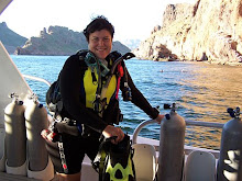
Well, it's an adventure and it's fun! It is also jam-packed with awesome views of the most breathtaking scenery you have ever seen. I had been contemplating leaving Arizona in the next year or so, but the landscape in the Navajo Nation made me fall in love with Arizona all over again. I think I just hate Phoenix. I started prepping for the trip during the week, as being a Lady of Leisure (i.e. unemployed) and went to REI to shop for hiker chow. Hiker chow comes in packets where you simply add boiling water, seal the pouch for about 6-9 minutes and viola, a gourmet meal awaits you after a long day of hiking. It's usually high calorie as it's meant to replenish your energy after all that hiking. There are several brands, Mountain House usually my favorite. I usually get the beef stroganoff and for breakfast the blueberry granola as all you have to do there is add cold water. But this time a pouch labeled "Biscuits and Gravy" caught my eye. Hmmm.....I love biscuits and gravy for breakfast. So I took that one. I bought the single serving of beef stroganoff and a packet of powdered milk so I could have milk in my coffee as well. When I got to the cash register I was delighted to find out that I had REI dividend credits available so the food cost me nothing! REI operates as kind of a co-op and every time you buy something you get credits toward a dividend you can use to purchase other things. As my finances are limited, this was a blessing. What serendipity, as the whole weekend turned out to have! I got my pack ready with all 30lbs of water and my other gear. I had borrowed a Big Agnus backpack tent from a friend as I was thinking about buying it from him. I would still like to buy it from him, but as it is, right now I ain't got no money. So he let me use it for the weekend and I really liked it. Saturday morning I headed over to Bernie's place to leave my car and pile in with Mike, Kirby and Bernie to carpool to the meeting location with everyone else. Everyone else turned out to be Ron (The Professor) and Diane (Gilligan). Just kidding. Ron is indeed a professor and Diane did get stuck in quicksand as Gilligan often did, but I am getting ahead of my story. When I got there, the boys were tying things to the roof of the SUV. After much re-arranging we got under way. Diane drove her SUV and Ron rode with her and Mike, Kirby, Bernie, and I rode together. We re-grouped at a vegetarian restaurant in Flagstaff called Macy's. When they mentioned Macy's I thought, the department store? Odd. But Macy's is a popular vegetarian hangout in Flagstaff, very bohemian, and you can get some good coffee and pretty decent vegetarian cuisine. It's like dining at the automat though, as you go up and order at a counter and if your order is for a hot dish, they hand it to you to go zap in the microwave. I ordered broccoli and cheddar quiche and it took about three tries in the microwave to get it heated up. But it was delicious as most anything there is. I am not vegetarian but can go that way sometimes, whereas Ron is vegetarian but will make exceptions sometimes, especially if it's Haggis. We ate/drank up and headed for Tuba City to eat yet again.
Tuba City is on the Navajo Reservation in Northern Arizona. The Navajo name for Tuba City, Tó Naneesdizí translates as “tangled waters” which probably refers to the many springs below the surface of the ground which are the source of several reservoirs. Tuba City is located within the Painted Desert. Most of Tuba City's residents are Navajo with some Hopi. The written history of the town goes back more than 200 years. When Father Francisco Garcés visited the area in 1776, he recorded that the Indians were cultivating crops. The name of the town actually honors Tuuvi, a Hopi Headman from Oraibi. Chief Tuuvi converted to Mormonism around 1870, and invited the Mormons to settle near Moenkopi. The present-day town of Tuba City was founded by the Mormons around 1870. In 1956 Tuba City became a uranium boomtown as the regional office for the Rare Metals Corporation and the Atomic Energy Commission. Five miles to the west of Tuba City is an attraction involving dinosaur tracks. Kirby very much wanted to stop and look but we were kind of on a time constraint to get to Navajo in time for the trail orientation. You must attend an orientation to gain your permit to hike to Keet Seel. But we did stop for lunch at Kate's Cafe, renown for it's hamburgers and sometimes hair in the food, but this time our plates were hair-free. I ordered the amusing secret recipe soup which involved cabbage, potatoes, celery, onion, and what looked like baco-s. A cup of that and a piece of classic Indian Fry Bread and I was set. Ron made an exception to the vegetarian rule and had a bowl of the soup as well. It was graduation day in Tuba City and everyone seemed to converge on Kate's for after ceremony eats. Some oldsters dressed in their traditional Navajo attire, but most were dressed in modern clothing. There was one girl, a graduate I am sure, dressed in a traditional costume and she looked beautiful. I wish I could have taken her photo but it might have been a little insulting. I thought of a fair trade where she could take my photo dressed in traditional Biligana (white man) attire of jeans, Keen sandals and a PADI Total Submersion T-shirt. But who wants a picture of a stranger in a t shirt and jeans in their photo collection? But, teens will be teens as we noticed and there was a large table with a row of young boys all busy text messaging during their lunch.
The Mowry Gang
We set off from there for the roughly hour's drive to Navajo National Monument. When we arrived we went immediately to the visitor's center for orientation and to claim our permits. The sky was pretty threatening and I began thinking of contingency plans as the trail to Keet Seel is treacherous enough on a good day much less with flash flood possibilities. I was hoping for the weather to clear up. As we were waiting for our orientation, another hiking group showed up headed up by Mike's arch rival, the Evil Don Mowry. Mike and Don apparently have a little competitive blood between them with regards to hiking. As in, who can go the fastest. I personally don't understand the reasoning behind power hiking unless it's for exercise. I am content to lumber along at my own pace. Every time Mike would mention something about competing with Don, Kirby would start whistling the theme to "The Good, The Bad, and The Ugly" which was fairly hilarious.
We camped out at the Sunset View campground where there are no ground fires allowed, so we all turned in fairly early after feasting on shared dished I urged everyone to bring. I didn't sleep very well, as I never do on camp-outs, and I was stressing on what the weather was going to be like and whether or not we would be forced into taking the dreaded upper trail which I heard was far more strenuous than the river. But the next morning was sunny and looked promising. The Mowry Gang was packed up and ready to head out long before us and that did not bode well for the Mike/Mowry rivalry. Things were a bit of a kerfufel that morning with regards to finding battery packs, lost car keys, malfunctioning hiking poles, and various and sundry delays. Kirby is an avid photobug and couldn't find his extra batteries for his camera. Then Diane couldn't get her tent poles to lengthen and stay that way, and Mike saw Bernie's car keys laying on the ground and he picked them up and put them in his pocket. Diane gave up on the hiking poles as not even the engineering genius Professor Ron could even fix them. Bernie urged us to move forward and they would catch up as soon as Kirby found his batteries. I was confident they would as I know Bernie can hike at a pretty good clip, and I don't.
We started down the road which is about a half mile approach trail to the actual trail head. The trailhead is for Keet Seel and Betatakin Ruins. Betatakin is located roughly across from the visitor's center in another canyon. It is an expansive ruin and I must return some day to explore it. It is a ranger led only tour as well but a day hike so you can camp out and hike and come back and camp some more, or take a room at the nearby Anasazi Inn in the hamlet of Tsegi.
When you start down the trail, you get a spectacular view of Dowozhiebiko (pronounced Dowozhiebiko) Canyon. This canyon leads out to the hamlet of Tsegi where the local ranchers can access the canyons via horse, truck or ATV and check on their cattle and horses. The cattle and horses are the reason no one can filter the water in Laguna Creek. There are also traces of heavy metals as in uranium, and no filter can get that out. I have had hikers on previous trips argue with me about this and the fact they think it would be perfectly okay to filter the water. I decided that if I had anyone on this trip like that I would say, go ahead and drink it. They signed the waiver and by the time they get giardiasis we'll have access to medical resources. It is a drag to haul all that water, but a necessary evil.
We descended the cliff to the canyon floor and when we got to the junction of Betatkin trail and the continuation of the Keet Seel trail Bernie was sprinting toward us asking if we knew where her keys were. Mike of course had them and she had not locked the car because she didn't know where they were. We decided that it would be best to lock the car as valuables such as my purse were in there, so Mike dropped his pack, headed back up and locked the car. I was confident he would catch up as he is a machine and is continuously honing his hiking speed to gain advantage on Mowry.
We reached the first of about 500 water crossings and began the trek down Dowozhiebiko Canyon to the junction of Keet Seel Canyon. It is marked by three white posts, the first of which is just beyond the first water crossing. You follow the white posts and they will guide you into the correct canyon. We slogged in and out of the creek trying to avoid the quicksand but sometimes we would find ourselves getting sucked in. It isn't like quicksand you see on Gilligan's Island where it looked like oatmeal, nor like in Tarzan movies where all you would see was the pith helmet of the explorer unfortunate enough to fall into it. This looks like solid damp sand and when you jab your hiking pole into it a few times it gets to looking like chocolate pudding. If you step in it you start sinking and it grips pretty hard. I've heard of people leaving shoes behind they could no longer find after getting stuck in quicksand. The quicksand has never been much of an issue in the previous times I've hiked this trail, but this was the rainiest I've seen it and the quicksand develops after it rains. Peachy.
We regrouped at the Big Waterfall, which about 35ft high and you have to climb up around it. From the top it's about 2 miles to the campground. The decision had to be made of the upper trail or the lower trail. I had never hiked on the upper trail as I am lazy and this one has always been reported to be more difficult. By this time on the trail I am usually fairly knackered and the thought of trundling up deep sandy hills doesn't appeal to me in the very least. It wasn't raining, nor did it look like rain in any direction so it was decided that the probability of a flash flood was slim. In places like Arizona and anywhere in the desert southwest, it doesn't have to be raining right there on you for danger of a flash flood to be imminent. It can be raining 30 miles away and flood waters can drain into the gullies and washes leading right to your feet and sweep you away never to be
 heard from again. It's happened time and again to the hapless traveler in cars crossing washes, and hikers and campers unlucky enough to be caught in such a place.
We decided to risk it. There are some interesting rock falls and a couple more beautiful waterfalls on the lower trail. I didn't consider that the quicksand would be waiting in quiet repose for us after all the rain in the previous days. We passed the turnoff for the upper trail and headed in to the narrows, also known now as the Chasm of Quicksand. We would sink a bit here and there approaching the next to largest waterfall and when I tried to lead the way up the waterfall that I was familiar with I sank past the tops pf my boots in quicksand. For a couple of lively moments I stepped in and out of it trying to escape but there seemed to be nowhere to go to get away from it. I would get sucked in everywhere I went! My legs charley-horsed and it was painful struggling to get out, especially with a heavy pack on. I finally freed myself as the others cheered on, and I got up the waterfall. I was able to wash my boots off in the rushing water and was looking forward to getting settled in to camp and taking those nasty boots off at this point. We continued and Diane chose poorly a route in the creek between two large boulders. The next thing I know she's mumbling some expletives and is almost up to her mid-thighs in the suck. The rest of us dropped our packs and attempted a rescue. She was able to free herself a bit, we took her pack and camera so she could free herself easier from the muck. This was getting to be like a trip down the Amazon on The African Queen. Of course without a boat.
We made it to the campsite without incident and it was decided then and there we would be exiting the next morning on the upper trail.
The Mowry Gang was already there and had taken the large picnic table though there were only four of them and six of us. They were gracious though and offered up space at their table but Mike refused saying we were content with our four man table. No way were we breaking bread with The Mowry Gang! We set up tents and took some rest before the tour of the ruin. The last time I went out here I opted out of the ruin tour as I had been two times before. But there was a special ranger there this time and Ron had indicated he knew where the spring was that the rangers used to get water and if the ranger wasn't looking he would show me. They used to let hikers replenish water there but after finding discarded shampoo bottles and various other pieces of garbage, they made it off limits. After reaching the ruins we decided against breaking the rules and sneaking downstream. I am not really in a financial capacity to pay tribal fines for violating permits to see a spring, even if there are petroglyphs to see.

The ranger that was there was named Steve Hayden. He was busy with The Mowry Gang and we waited at a scenic overlook for them to return. When they approached one of them said, "Oh, you all finally made it" to which Ron replied, "We've been here for hours, even had a nap". Mike looked at Don and said "Hello, Mowry" and darned if Mowry didn't just snub him. This meant war, obviously, and Mike had the eagle eye on him the rest of the time.
Ranger Steve's grandfather , Irwin was in charge of the excavation along with his son who took pictures. Ranger Steve is now working on a book about the endeavor. It was a treat to have such a tour guide. He was able to explain all the politics involved and the things his grandfather and father experienced while working at the site. I tried to con him into letting us go to the Turkey Alcove and Turkey Cave just upstream as they are unexcavated and I have always wanted to see a pristine ruin. These sites are probably not completely pristine as the likes of the Wetherhills and others have been rummaging around these parts for nearly 200 years. Steve informed us that the site could be closed at any time as the safety is precarious at best. You have to climb a 70 foot ladder held to the cliff facing with bailing wire at best. As soon as you ascend the 70 foot wall of hell, you are on insidious ground as erosion and unstable ruin walls make it a delicate tour at best.
Once we completed the tour it was back down the ladder of death to the base of the ruin. We marched it back to camp despite my extreme desire to break the rules and sneak over to the Turkay Alcove, but why risk a tribal fine? We dines on our various pouches of hiker chow and believe me, that freeze dred stuff can be pretty tasty after a grueling, laborous hike though mud and quicksand.
Biscuits and Gravy
The next morning brought on the biscuit and gravy project. As mentioned earlier, hiker chow is meant to be simple. Then when I read the method of preparation for the biscuits and gravy I was ready to have beef jerky for breakfast and call it even. There were not one but two pouches involved, lowering heat to a simmer was involved and dropping the dough into the gravy was involved. It was more like dumplings and gravy instead of biscuits and gravy. I managed to cook some of them and shared with Ron but gave the remainder a Christian burial out in the woods. I need to interject here the difficulty in lowering a camp stove to a "simmer" as well. The things are meant to boil water and that is about all. Emeril would not be using a camp stove, there just aren't enough heat settings. Boil n eat. That's about all backpacking food should involve.
We stayed on the upper trail on the way out and it proved to be a much better choice. When I go back next year (did I just admit to that?) I am using the upper trail both in and out. Mike took off ahead of everyone and I was confident he was going to catch up the the Mowry Gang, but Ron and I caught up to him and Diane along the way. Ron and I hiked together for a long time having philosophical discussions about such deep topics as cosmology and dating websites. We crossed the sand dune near the swampy area dn there was something on the ground ahead of us that looked bloody and was drawing flies. We stared at the bio-mass for a good long while, and I mentioned it looked like a job for CSI as I couldn't make heads or tails, literally, of what it may have been. Ron snapped a couple of pictures and we were off. Later that evening over dinner in Flagstaff we decided it must have been some sort of afterbirth.
At the base of the cliff, we offloaded what would have been extra water and we all started up. I fell behind almost immediately as I was very tired. I hiked up alone for the most part left to daydream and ponder things and I couldn't decide what ate my lunch more. The sand dunes that went straight up the hill or the steep stair switchbacks. I eventually made it to the top, thinking, never again, but I have a feeling that wasn't my last trek to Keet Seel ruins.
For a full pictorial, click here.
Until the next adventure,
The ScubaJedi
No comments:
Post a Comment