Deliverance
According to the write-up on the Coronado National Forest website:
“Box Camp Trail provides some of the most dramatic views of any trail in the Santa Catalinas. It is also steep and rocky, and, as you might expect, the most rugged sections also offer the best views. Extending between the Catalina Highway in the vicinity of Spencer Campground and the East Fork Trail in the Sabino Basin, during summer most people hike from the top down. During the winter, use increases on the lower (warmer) end of the trail.”
We started hiking from the top, on a typical sunny/cloudy day in August. There were 10 of us total and as the trail moved through large ponderosa pines before dropping into the Sabino Basin below, we got somewhat spread out with faster hikers out front and more casual hikers going at a slower pace. But I am getting a little ahead of my story, and I like a story told well from start to finish, so that’s actually where I will begin.
I had wanted to lead what is categorized as an “A” level hike with Sierra Club. The hikes are rated from hardest being “A” to easiest being “D”. Box Camp Trail is a solid “A” hike with over 4000’ in elevation change and being over 9 miles long. The distance is debatable as I get a different number depending on who wrote the description. On August 19, 2006, the trail seemed to be over 100 miles long.
I never hiked this particular trail and didn’t want to officially lead a group of people through a trail described as being difficult with brittle rock littered with rubble. In some places the trail was reported as being hard to find. That turned out to be an understatement, but again, I am getting ahead of myself. I decided to do a pre-hike where I would get a few friends to come with me and check out the trail before offering it officially on the Sierra Club Events Calendar. I was only going to plan for three, maybe four people and to do the hike in a two-car shuttle, as recommended, because of the distance and elevation change. I spread the word in the hiking community and at one time had 20 people interested in going. The usual phenomenon that takes place is a large number of people will be enthusiastic about going and then the number will dwindle more toward the day of the event, and in this case it dwindled to 10 brave souls. That turned out to be a very good thing. I did not know what to expect on this trail, only what I read about in several trail descriptions from several sources.
We spilt up into three carloads to carpool from the Phoenix area. I drove my trusty Nissan, Dave W. drove his trusty Nissan, and Deb drove her trusty Nissan. Their Nissans were Xterras and mine a humble passenger car, the Altima. We drove to Tucson and re-grouped at the Sabino Canyon visitor’s center where another Dave, from Tucson, met us up. We got to the visitor’s center sometime after nine in the morning and told the ranger where we were planning to hike. He was very discouraging as in the past couple of weeks the wilderness area where we were going to hike had been hit with some torrential flooding and landslides. The lower half of the trail had been completely destroyed, we were told, and therefore closed off.
Never one to let much stop me, I asked for alternatives and as it turned out, there was an alternative trail that went left instead of right at one point and we could complete the trail ending at another parking area called Prison Camp, which was the site of a WWII Japanese internment center. The ranger made it sound like the alternative was a good trail however couldn’t give us much more information than that. I asked if there were trail markers and intersection signs that would point us in the right direction and he was pretty brusque in his answer that he just didn’t know. We were all experienced hikers and route finding ability a strong suit with us, which turned out to work in our favor. That and an accurate GPS.
We piled back into our respective vehicles and headed for the Prison Camp parking area.
We left my little Nissan at the Prison Camp parking area, which was mostly destroyed by the recent flooding. We could only park a little ways in and the ranger at the center had told us the drive went well back into the site area where there was a circular drive and we should park towards the back. Dave W, our Dave from Phoenix, was kind enough to purchase a topo map of the area which indicated that our alternative route would lead us to a dirt road leading to this parking area.
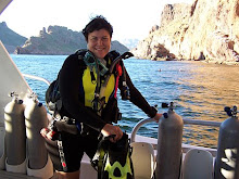
From here, we drove in the two Exterras to the trailhead at the top of the mountain. Everyone was in high spirits as it was lovely and cool out at the top and it was promising to be a beautiful day. The trail climbed a bit from the parking area and Deb and a few others, Steve, Mike, Kathy, Willy, and Dave from Tucson took off ahead. Nunya, Dave W, Bruce and I sort of moseyed along behind. Nunya likes to chronicle the hike in pictures and usually stays in back.
The trail in this area was easy to find and beautiful. There were tall ponderosa pines, ferns, wildflowers, and a babbling brook to accompany the babbling hikers. We e
 ncountered a couple riding mules on the trail and two other hikers with dogs who said they had come up from the bottom. I was silly enough to believe they meant the very bottom and therefore the trail was going to be a cakewalk. Stupid me.
There was a trail intersection with Box Springs Trail and when we consulted the topo map discovered we had only hiked about an inch and a half. We had a very long way to go and it was about noon by then. We moved on laughing and having a great time in the cool pines and taking in the beauty surrounding us. We broke out from the trees to a sunny rocky outcropping where Deb and the others were stretched out on the rocks having their lunch. We met up with them and sat down to eat as well. After a brief resting period and some laughs and group pictures we were on our way again. As usual, Deb and her faster hikers went on ahead and Nunya, the two Dave’s, Bruce and I were trailing behind. The trail started getting steep and rocky at this point and it did become challenging to find the actual trail. Between the absence of a defined trail and overgrowth in places, it got to be like a game to find the trail. Bruce suggested we start playing a trail game, which involved someone coming up with the title of a movie and whatever letter that movie titled ended in the next person had to come up with another movie title and so on. We played that for a while until trail finding became a real challenge. Notice that I use the word challenging where I really want to say pain in the ass.
We hiked down to a rushing drainage where we came upon Deb, Willy, Mike, Kathy, and Steve. They were as confused as we were about where the trail actually was. There was a beautiful waterfall suitable for a picture moment and a consult of the mostly useless map. I was becoming more concerned as the day was wearing on and we really didn’t have a clue where the blazes we were. We followed cairns down to an area where we were able to strip off the boots and wade into a little waterhole. That was refreshing and particularly for Willy, added some vigor to his step. Willy isn’t used to hot rough hikes in the wilderness. He is from New York City and is making a progressive transition into being a wilderness man. This hike was rough, and getting rougher. Dave from Tucson was also showing some wear at this point. As for myself, I was just starting to go into high whining mode due to mental exhaustion and my tendency to freak out in situations where I feel out of control, and I was starting to feel more and more out of control on this fine day.
We thought we were at the point where we needed to find the eastern trail that would lead us back to the Prison Camp car park. We decided at this point it might be a good idea if we all stuck together as none of us had a clue where the trail was at this point. Deb was excellent at finding the cairns and we were just going from cairn to cairn. Daylight was going to become a problem soon, or lack thereof. Also, water supplies were dwindling for everyone. Nunya and Deb had headlamps and Dave from Tucson had a little flashlight. Willy, in his infinite wisdom, had brought along a GPS and had marked where the Prison Camp car park was and that literally saved our lives. He was feeling more than a little exhausted and so I took over the GPS monitoring. It made me feel a little better to have control of that as I could see that we were indeed heading in the right direction, but the mileage was at nearly 4 and a half and daylight was dwindling fast. We ended up bushwhacking down to the basin where a fast moving river was. In looking it up later, this was the river we were to cross just before we hung a left to the East Fork trail which led to the Sycamore Reservoir Trail, which led to Shangri-La, also known as the Prison Camp car park. There were no trail indicators or anything to reassure us where we were. The scramble down the escarpment was an insidious, steep, and in my humble opinion dangerous trip to the river. But we had seen a definite trail on the other side of the river, the GPS was pointing to it and cross-country was the fastest way to get to the river at this point without taking the time to hunt for more cairns. Ordinarily, I would have been having the time of my life, as it was truly a beautiful area. The rapid running creek, large trees on the shorelines surrounded by dramatic mountains made for a majestic place in which to be. But it was on this scramble to the river where I pretty much lost it and started to weep. I thought all was lost, we were all going to die and it was my entire fault for organizing this little safari. I guess mental exhaustion, physical fatigue and the feeling of powerlessness overcame me and I just needed to release. The others were wonderful and assured me it was not my fault.
Dave W flushed out a large angry rattlesnake as we approached the river, so we had to navigate around it. That was the first of two rattlers we saw that evening. The river was gushing, but there were plenty of dry rocks to step on to get across. I was thinking that the forest service, in their infinite wisdom, should just come out there and stock it with crocodiles to make it even more of an “adventure” than it already was. We crossed and found a real trail and began to follow it. Steve decided that he would run ahead and hopefully get out before dark so at least one of us would live to tell the tellin’. We once again got spread out. Willy and Dave from Tucson were suffering pretty badly by now and Nunya, Dave W, and I hung back to make sure we were all okay. Bruce sort of hung out in between groups, and would stay at more treacherous parts of the trail to help us out when we came to things like, oh, major landslides that took out the trail in parts. The trail was climbing as Mr. Ranger at the Sabino Canyon Visitor’s Center had promised it would. Oh, what’s a little uphill for a bunch of seasoned hikers like us? After the trip down the Cliffs of Insanity I had very little uphill or downhill steep going in me. I was highly motivated to make time and get out before dark, but I began to accept the fact that that was not going to happen. We were going to be stuck out there in the dark; there was no getting around that. We climbed and climbed and scrambled over rockslides and at one point I fell on a slide area and saw my life flash before my very eyes. Mostly I could just see myself going ass over applecart down the rockslide only to land broken and near death 1000 feet below. Bruce was there and gave me a hand up. I tried remaining jovial about it and remarked that my butt created a shelf for the others to use to get across. Bruce was ever so kind to brush the dirt off my ass, and I told him he got that feel-up for free because I was too tired to slap him.
Everyone made it across that landslide and we crested the saddle. There was, by crackie, an actual trail sign at the junction. Deb’s group placed an arrow made from sticks on the sign to indicate their direction. I knew we needed to head for Sycamore Reservoir and it looked like we were on our way. The trail was still obvious and I was optimistic that we just had to walk easily out of there. Silly, nutty, naïve me.
The water situation became grave. I was completely out, as was Willy and Dave from Tucson. Bruce had a bit of water stocked up but he had filled some containers with river water just in case. I thought, what’s a little giardiasis when you’re thirsting to death? So at the next stream crossing I filled up. The water did not taste bad at all and I was confident that it was clean. The runoff was fairly fresh and the water was running. Mom always told me that running water was okay to drink. She also gave me ex-lax when I complained of a headache once when I was little. But, you had to know my mom. By now everyone had river water in his or her various water containers. The trail remained obvious and even though it went in and out of the creek many times, we always managed to find it. Then it got dark. Like, really dark. There was a glade of large trees and then the river bent around after that. I was steaming on ahead and by now walking in the water fully shoed with my non-waterproof boots because I could care less how wet my feet got. I had other problems.
We eventually stopped to make an assessment of our predicament. We could see we weren’t far from the road as we could see cars driving by. But while it was still light out we could see that it was a steep climb to get to that point. But how did one get to the road? I took the headlamp and went looked around for the trail that must be on the banks of the creek somewhere. In the meantime, Nunya decided to pitch camp. She had a fully stocked backpack on her as she was training for a trip in the Sierras next weekend. What a woman! When I got back, the tent was up and we built a fire. We decided we would just have to remain there till daylight. Dave from Tucson indicated that he just couldn’t go on. None of us had cell signals, so there was no calling for help. It wasn’t so grave, though, as none of us were injured or damaged in any way, there was plenty of water (thank you creek) and we had each other. Bruce volunteered to go look for the trail once again, if no results he would make for the road. We had no idea what good that would do, as we did not know which direction we should really be heading. The GPS wasn’t pointing to the road, but we thought at least we might be able to get some help. We took down our GPS coordinates, w
 rote them down on a scrap of paper and gave them to Bruce and wished him Godspeed. After he took off, we decided to entertain ourselves and see how many people we could get into a backpacker tent. So Nunya got in, followed by Dave W, then me, then Willy. The four of us spooned and got very snuggly and as comfortable as you could get. Dave from Tucson was lying down in the sand outside taking some much-needed rest. The four of us in the tent were giggling and getting comfy when Bruce returned announcing that he found the trail! There was a sign about a quarter of a mile back indicating that the parking area was 1 mile away!
So we packed up the camp and headed for the trail. Naturally, it was all uphill. Dave from Tucson would fall behind and we would wait for him calling out to make sure he was okay. He did really well trundling along in the dark. Bruce was up front with the headlamp and flushed out another rattlesnake. It was a little one and didn’t even rattle. It slithered into the underbrush and didn’t bother us, and we didn’t bother it. I was so tired I was ready to extend my hiking staff and flick the serpent into the brush just to get it out of the way.
Across the ravine and towards the road we began to see signal lights and were sure it was Deb and company. I thought they were in the parking area as the only car there was mine and I had the keys. So it was seriously damaging my calm when we would continue to climb and seemingly go in the opposite direction of the signal lights. But according to the GPS, we were right on track. We crested a saddle and there was a wilderness sign. It told us jack squat, just like the rest of the signs we encountered. The original sign at the beginning of that trail we were on indicated a mile to the car park. That turned out to be wildly inaccurate. The GPS was spot-on as it turned out. From here we followed an old road down to the old Prison Camp area where there were a number of tents pitched. Apparently some trail crews were camped out to work on the dreadful trails out there. They have a lot of work ahead of them. They told us that Deb and her crew had been by and told them about us and had hitched a ride up to where Deb’s Xterra was parked. When we piled in my Altima, we drove out and there was Deb and company coming down the road. We all hooked up again and everyone had a different story.
Kathy had gotten separated from the others and ended up losing Deb after the switchbacks, down by the stream. She got off trail (not intentionally) and scrambled up a hill to get a better view to look for anyone. She then returned to the stream and couldn't see any of us coming over the hill. She figured we must have gotten ahead of her. So she just followed the water for a while, crisscrossing it a few times and following footprints. When she came to a waterfall and/or dam, she knew she was lost. She told us she had to scramble up the hill on all fours and that hiking method would become her primary means of crossing as the steep cliffs continued! There she caught a glimpse of car lights coming down the hill to the left.
For the next few hours Kathy headed that way. Because it was dark, she had no way of knowing the best way to traverse. Fatigue caused her to stop frequently, and this is a normally strong hiker. She ended up going up and down two big hills and on the last ascent she caught sight the car lights and flashlights. Kathy yelled and they responded, but there was still quite a ways to go and she had to keep stopping. Steve shone his light on her and then came out to meet her. He then directed her back and went on a search for us, though we never saw him. Who knows where we all were at that point? Kathy was quite surprised that it was only the three of them at the top. She had assumed that everyone was out by then. Mike met her near the top and got her safely back to the car at 10:30pm where she did nothing but sit and drink water and coke for the next hour. That was amazing. Had I been separated from the others with no lights nor knowledge of where the trail was I would have cowered into a space and cried like a little girl till morning.
Deb and Mike had bushwhacked up to the road and flagged down a Good Samaritan and got a ride up to the trailhead. They had called 911 for us but then called it off as we were delivered.
Nunya, the Daves, Bruce and I stopped for food and coffee at the Village Inn, and then headed for home. I got to bed by 5:30 in the morning.
From Nunya (Nunya’s) Experience:
The Hike of Insanity.... you hear about them, you wonder if it will ever happen to you... wonder no more. The Catalina Mountains - Sabino Canyon, Tucson - we were told at the Ranger Station that the trail we had planned had been rendered impassible by the prior weeks flash flooding, rock slides and avalanches, but that there was an alternate route we could take. They were wrong.
To say the routes in the area were impassible is not totally accurate, but to say the area/trails/routes were obliterated - yes. What the 10 of us hiked into was beyond comprehension, and it made my prior weekend Class 3 & 4 rock scramble seem like a walk in the park. The intensity and duration after one point became so bad, that photo taking was abandoned for survival.
I was also conditioning for an upcoming backpacking trip, and had a loaded backpack of basic camping essentials (35+lbs which later felt like 70) - both a curse and a blessing because 6 of us made use of the contents, and having it certainly zeroed out my stress in considering our options. Handling that backpack down and up the treacherously precarious embankments of loose rock and terrain in Marine Boot Camp/Navy Seal fashion (and without being sore the next day), removed all shadow of doubt that was I conditioned 'just fine' for anything!!
Exhaustion and fatigue were the first issues to deal with within the group, followed closely by running out of water. Since my water pump still needed REI repair, we had to put our fears aside and drink the rapidly flowing creek water untreated - hopefully without side affects. The options were death now or diarrhea later - we drank the water.
With the aid of a GPS, we bushwhacked following no visual trail, but some precariously set carins - eyeing a trail in the distance that we knew would lead back to the vehicles. Once reaching that oasis trail point, we quickly found our danger had in no way been alleviated. Multiple creek crossings with the extensive flood damage and avalanches had successfully destroyed normal means of locating what was left of the trail. Four of the stronger hikers had went ahead to bring back fresh water, only to face the same fate as the 6 of us left behind - being in the canyon in the dark, with no trail to follow and steep treacherous terrain to scale. Everyone felt emphasis on the danger and drama as calmly and quietly as could be done considering the circumstances. Dangers of rattlesnakes, mountain lion type animals, bears and other biting things paled in comparison to the terrain we faced.
It is my understanding that one hiker (Kathy B) also became separated from the leading 4, and managed to find the trail in the dark and essentially alone, and exit the canyon around 10:30pm. This can only be attributed to an act of God assisting her. Even with the 6 of us eventually locating the trail with the aid of my headlight and a GPS - knowing how to follow it in the dark with all the damage and no GPS was a miracle she should be highly commended upon. The other lead 3 it is my understanding, went through the creek canyon floor and scaled the cliff in the dark (with one headlamp) to the road - an option we 6 had to abandon for safety reasons.
Teamwork between the remaining 6 was amazing, everyone doing some little part to make it as easy as possible. The camaraderie, the courage, and no one gave up - it was truly an experience we hope to never be faced with again, but will laugh over sushi later this week on how we fit 4 exhausted hikers in a 2 person tent.
From Steve’s Experience:
Since we all had the same basic experiences until we arrived at the creek, I will start my version from this point and bring it forward.
As Willy, David, and I traversed the final descent, which led up to the creek, I heard the Siren’s Song beckoning me into her arms. She proclaimed that she lacked all modesty, and was naked and waiting impatiently for me. God, I am such a sap. I sprinted down the final terrain only to find a fully dressed, back pack carrying, mortal laughing at me and swearing that she HAD been naked (beneath her clothes). Arriving at the creek at approximately 1700 hours, I removed my footwear and submerged my fat little body into the water in order to cool off. When the group resumed hiking, I decided to move ahead to the front of the parade. Therefore, I sped up my pace to a more comfortable rate, and met up with Deb and Mike (henceforth known as DaM). After we met up with Kathy, I decided to forge ahead at an even more comfortable pace, since I was confident that I could make it out safely before sunset, and therefore be able to contact someone and let them know that there was a group of hikers still in the area. After leaving DaM and Kathy, I had a couple of interesting experiences, including taking a ride in a landslide area. This occurred when I attempted to run across an area that had suffered severe erosion, and whatever I landed on took off down hill with me on it. I turned to face the direction of travel, saw what appeared to be a safe area to exit the ride, and hopped off when I reached it. After this, I arrived at the intersection of Bear Trail [?], Sycamore [?] Reservoir, and East Fork Trails. Since I wasn’t sure which way to go, I ran down Bear Trail for a ways, turned around and ran down Sycamore Reservoir, then came back and ran up the highest summit in the area, which was back down Bear Trail. I did this in order to try to get telephone reception, hoping to contact a fellow Sierra Clubber in order to get directions and let someone know about the situation. At this time my phone completely locked up, and I couldn’t even turn it off. Since I didn’t want others to follow the markers that I had left behind, and hoping to get directions from the next group that came along, I ran back to the trail marker just as DaM arrived. After consulting with them, I followed Deb’s wise advice, and followed Sycamore Reservoir trail out. She pointed out that, just as I had observed when we pulled into the Prisoner Camp parking area, this trail seemed to lead to a riparian area.
As I reached the riverbed flats, I decided that the only reasonable route to take was to the right, since we had parked at a low area, which was most decidedly a riparian area, and then immediately started an uphill climb in the vehicle as we headed up to the trailhead. Since the area where the road traffic had appeared similar to the uphill area from Prison Camp, and the area on the other side of the hill appeared to most likely be the riparian area, I stayed in the creek bed until I arrived at what appeared to have been a dam. From here I backtracked far enough to get away from the swiftly flowing feed waters, and then crossed over the creek. From here I followed a very old footpath until I encountered a VERY old iron sign that proclaimed that the parking lot was only one mile away. With a high degree of elation, I headed in the direction that the sign had pointed me. After about a mile I arrived at an area, which probably served as a parking lot when I was still wearing diapers. The only sign here was one announcing the area as part of the Arizona Trail. So I ran. At one point I encountered a hissing speed bump of the reptilian sort who was coiled up in the middle of a single-track footpath. Landing my right foot within inches of his (or her) smiling face, I performed a pirouette in the path and called the bastard every name in the book but a white snake. Eventually I arrived in another creek bed where I found horse prints, and I followed this. And I ran some more. Several miles later I entered Prisoner’s Camp, which had been severely damaged from the floods. At 1900 hours I encountered a wonderful group of friends who perform trail maintenance. Having just run out of water, they re-hydrated me, listened to my (our) woes, then loaned me a whistle. I ran to the top of the nearest mountain, and then blew (suck is just an expression) for several minutes. I continued until right at sundown, and then went back to their camp. Seems that the universe was working in our favor, since they were not scheduled to camp there, but their van had broken down right before they got to the Prisoner’s Camp parking area. After further re-hydrating me, they then proceeded to feed me a wonderful dinner of rice and chicken with peanut butter sauce. As the group leader said, “Hard work is the best seasoning for food” (Edward Abbey). After a couple of beers and a slice of chocolate cheesecake (not really), we did dishes using a system wherein there are four dishpans; one for pre-clean, one for soap, one for rinsing, and one for sterilizing. Four people line up and start washing dishes, then the next in line says move (or something like that), and everyone moves down a place and lets someone else enter the line. By 2030 hours we had finished doing dishes, someone gave me a rain poncho, which replaced the one I gave away on Mt. Humphreys’ last Sunday, and I was just getting ready to thumb my way up the mountain to get Deb’s Xterra, when headlights appeared in the parking lot. When I heard DaM’s voice, I was thrilled. Two of my newfound friends went out to greet them, and upon my arrival, we left with the good Dr. and his wife (the kind couple that picked up DaM from the side of the road. (Deb, road walking is okay, but DON’T start street walking, okay). We got the Xterra, stopped at some crazy lady’s cabin, tried to use a broken phone, saw the lights of hundreds of stranded hikers, then finally arrived at mile marker 8, which was where DaM, had entered the road. We were really excited at this point since we had seen a single headlamp down in this area, and had heard a verbal response when we called out. Moving down to a slightly lower area, which held promise for an easier egress route, I headed into the valley with the aid of a 4D Maglite, which the good Doctor had loaned us. It was especially fortuitous that this area provided us with a slightly flowing, gently sloping creek bed in which to travel. After going down into the valley, I heard a single voice, and since it wasn’t a voice that I normally hear in my head, I felt fairly confident that it was one of our party. I told her (Kathy) to not move, and just call me in. When we finally connected, she was visibly shaken and exhausted, but she still refused to give up. I located the creek bed, sent her up it, and then proceeded down into the valley to locate the individual that was wearing the headlamp, since Kathy reassured me that she was not in possession of any type of lighting. How she made it that far without lighting is beyond me. What an awesome individual, and an inspiration to me. Leaving Kathy, who I knew was capable of taking care of herself, I delved deeper into, and eventually crossed, the valley while holding the Maglite over my head in order to illuminate the trail well enough to run. Coming back, I stopped about halfway up, and shined my light down into the valley. It was at this time that I saw a set of eyes down by the lowest part of the stream. I yelled out to not move, and I headed back into the valley. As I approached, I lost contact with the eyes. But when I arrived at the approximate location where they had been, I found some really big cat prints. At this point I headed back up to the car, since I figured if there were any hikers down here now, their bones would eventually be located. On the way up, I did panic for about ten seconds when I could not tell which mountain was which. Talking myself down, I left the creek bed that I had decided was my best route out, and I gained a little elevation. When I saw that the scar in the mountain, which was a result of the two-lane road, which had been built into it, was where I had thought it should be, I resumed my ascent out of the area. After deciding that the headlamp we had seen was either a phantasm, or more likely one of our group, we headed back down to Prisoner’s Camp, where I ran out onto a high area in order to try to guide the group in with a flashlight. Finally, we gave up, and called 911. We had decided that the light was possibly part, or all, of our group and they had decided to use GPS, which gives distances usable to crows, to lead them to their destination. As we were leaving the area and heading down to leave a note on the vehicle parked at Prisoner’s Camp, we noticed the same vehicle leaving the parking area.
The end.
And they lived happily ever after.
Oh yeah. Then there was the guy at Circle K that gave me a large cup of coffee. What a great day. Life is good. Friends are better. Adventures rock. Deb, take those rocks out of your backpack, you sicko, rockaholic.
Lessons learned:
Learn the trail names that you are going to be using.
Only travel as the crow flies if you have wings.
Look at the maps, but read the landscape.
Rock cairns are technology also, and therefore are no substitute for experience.